rapidtransit.net brooklyn rail history
Maps from
Reports of the
Brooklyn Grade Crossing Elimination Commission
(published 1918)
by Bob Diamond
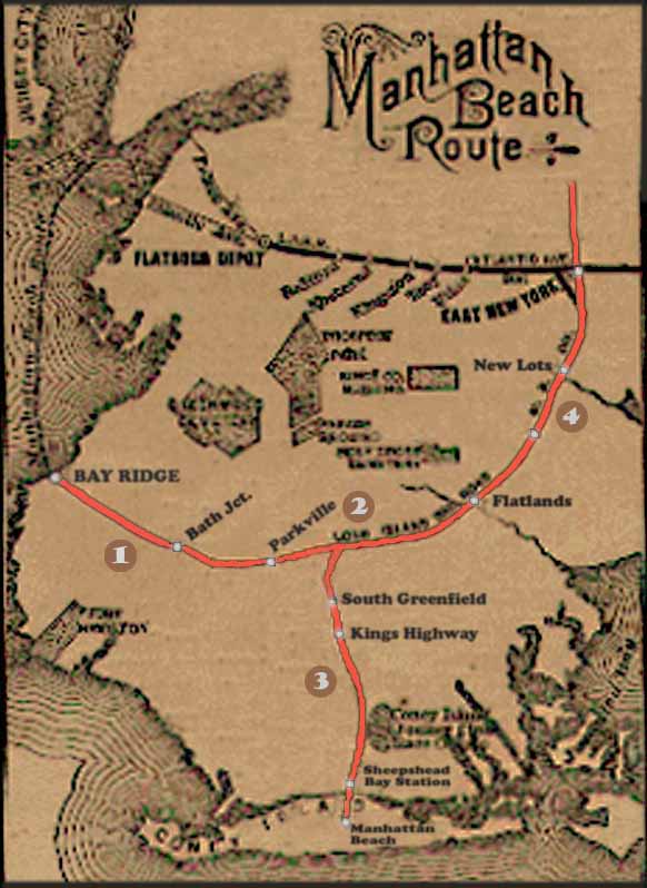
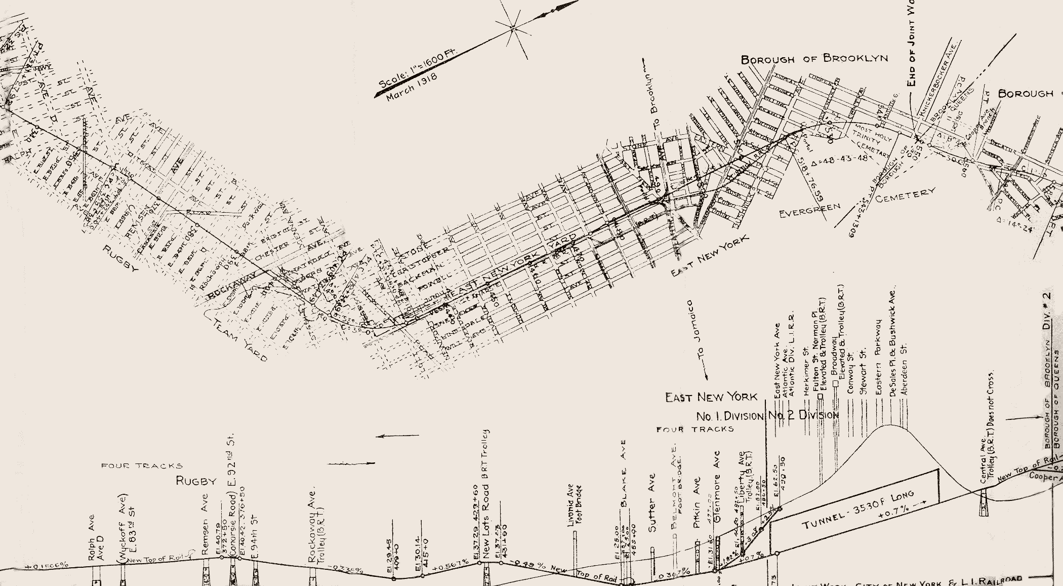
The above composite map shows the Bay Ridge Division as it existed in the late 19th century. The key numbers show the approximate locations shown in four route and elevation maps contained in the Brooklyn Grade Crossing Elimination Book.
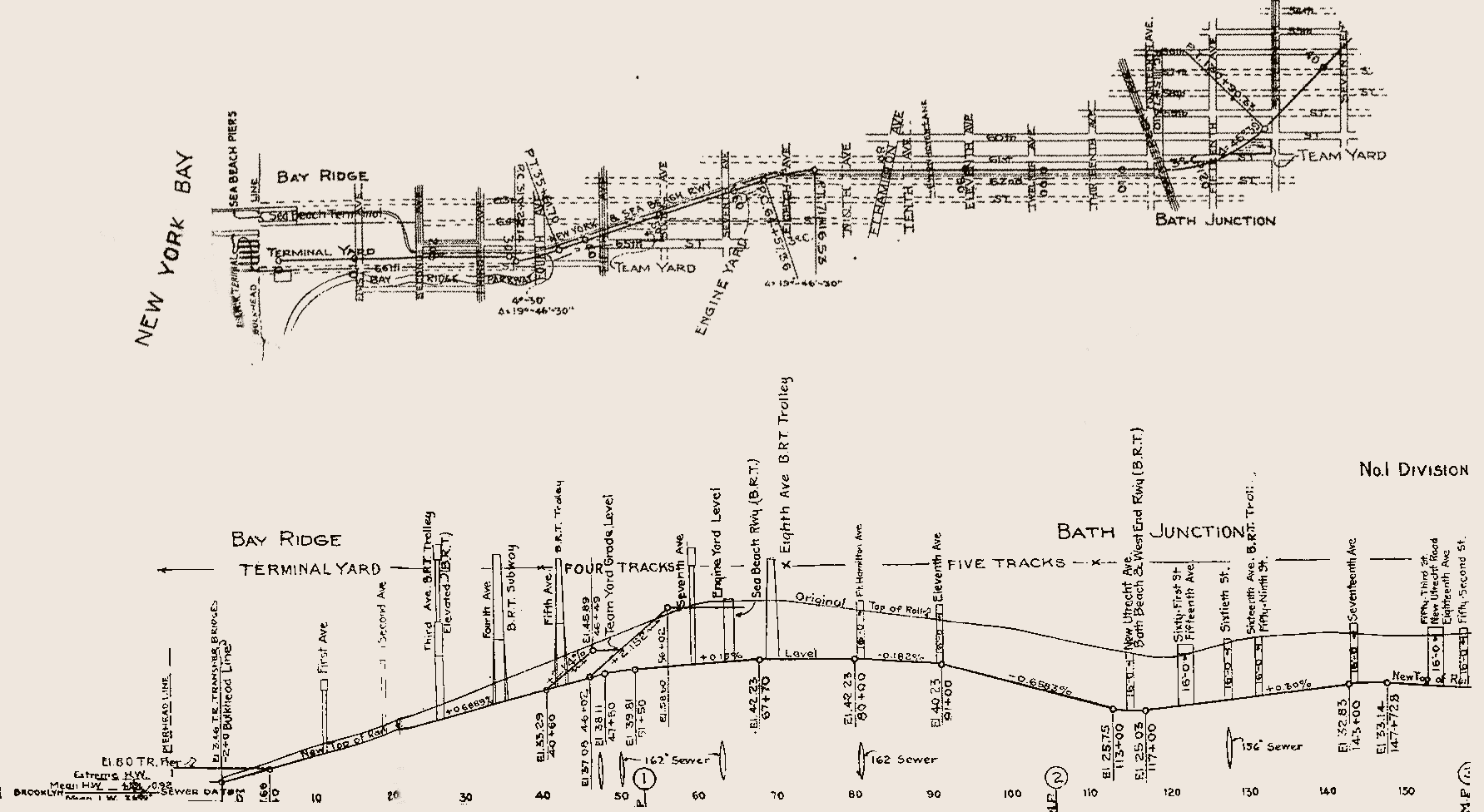
Map 1. (74K) Bay Ridge thru Bath (West End) Junction to 14th Avenue. Also shows the position of the original Sea Beach Line at the Narrows shore.
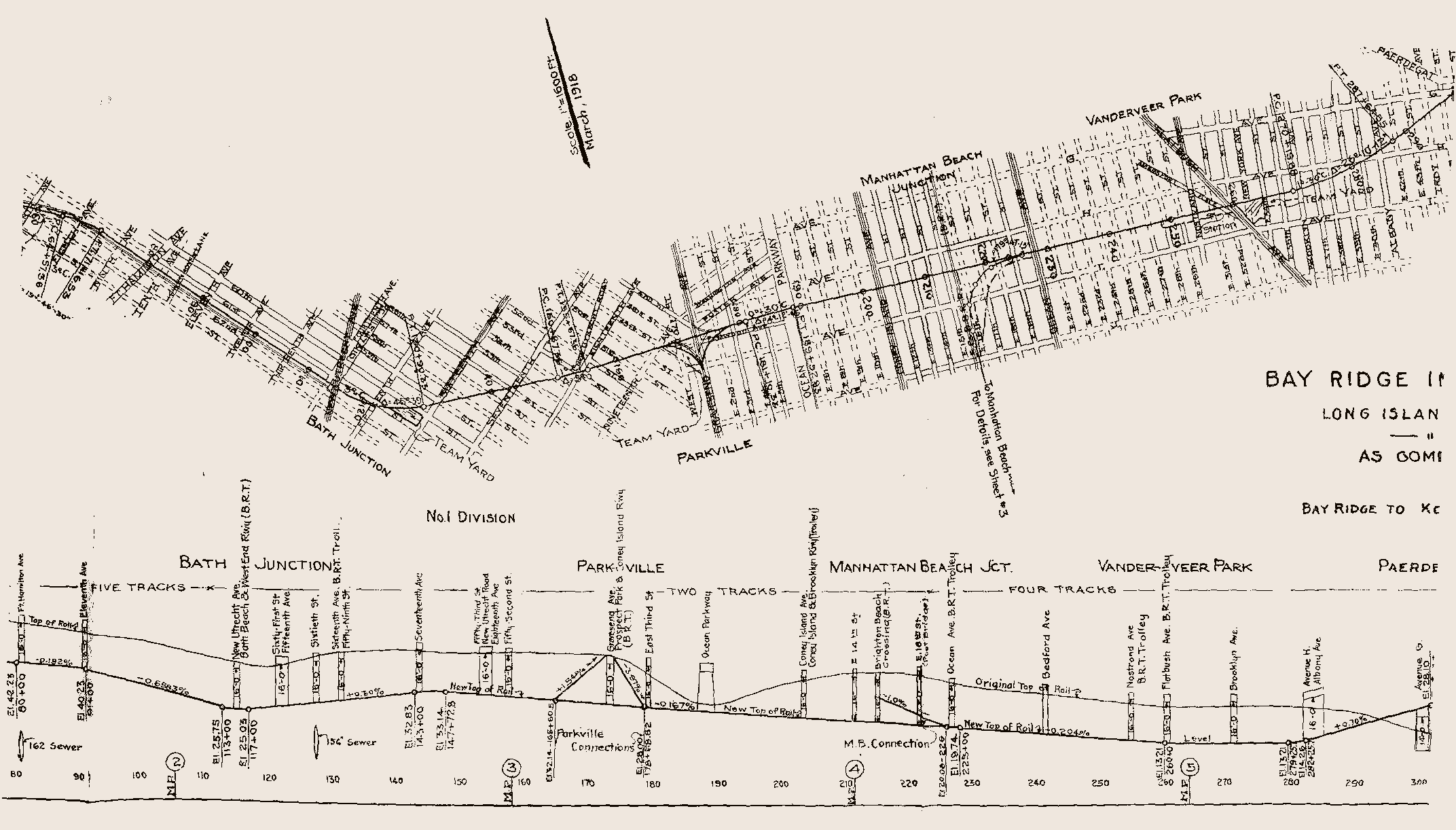
Map 2. (83K) Overlaps Map 1 from 7th Avenue through Midwood and Vanderveer Park past Albany Avenue. The junction with the Manhattan Beach Line is shown.
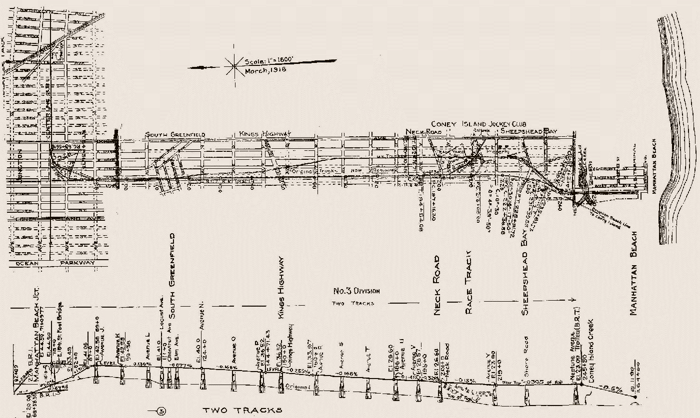
Map 3. (177K) The Manhattan Beach Line from its junction with the Bay Ridge Line to Manhattan Beach. Shows both new and original alignments. This map is turned so north is at the left side of the map.
Map 4. (144K) From about Ralph Avenue through East New York and the Brooklyn-Queens borough line.
Return to rapidtransit.net Home
Everything on this site is copyright 1999-2000 by The Composing Stack Inc., except as otherwise noted.
Materials with other copyrights are used by permission.
All rights reserved
Last updated